Sunday, June 29, 2008

Broadrick Sarawak Trip - 27 May to 2 June 08

DSC_0002Hey... this blog is to help you recap what we experienced during the 7 days in Sarawak. It also tries to get you to reflect on what you saw and relate it to your life in Singapore. Hope it helps. You all have been a wonderful and fun-loving bunch during the trip!

If you happen to chance upon this blog, it is a product of a Broadrick Secondary School Geography fieldtrip to Sarawak. We visited authentic longhouses, a hydro-electric dam, a cave, a beautiful forest stream and Bako National Park. If you're interested in a similar educational trip, you can contact Gasi Holidays.

DSC_0894 DSC_0895 DSC_0896 DSC_0674

Day 1 Sarawak Cultural Village and local fishing village

DSC_0022
Here's where we learn about cultural commodification.

Commodification means to sell something. In this case, the culture of various Sarawak tribes is being used to attract tourist dollars. For example, you can pay 10RM to try out these costumes and pose like the Ibans. Do you think that will be insulting to their culture? Imagine some Ang mohs visiting Singapore trying out the baju kurong and making silly poses with it. Will it offend you? DSC_0055

On the other hand, we cannot deny that we learnt something about the culture right? Such theme parks, although abit fake at times, actually play an educational role. Some professors argue that such performances help maintain the culture and make the locals proud of their traditional practices.

DSC_0063Recall how happy the Penan man was to show us how to use the blowpipe? And how happy the longhouse chief was when we showed an interest in their culture?


------------------------------------------------------------------------------------

Local fishing village

DSC_0094

How is this place different from Kuching?

The built environment  Buildings, facilities

The industry
Office/service vs fishing

Globalisation
Are there Macdonald's around?

DSC_0097

Cost of living

On the right: By products of the small-scale fishing industry- belachan and dried shrimp.


Take-away message
Is cultural commodification that bad?

How is the city different from rural areas in terms of development. Why?

Day 2 Oil palm factory and HEP station

Oil Palm

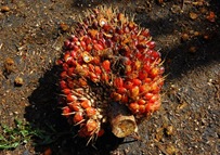
DSC_0282 DSC_0237 You should have your notes on oil palm processing already right?

Let's look at the bigger picture here; the palm oil industry as a whole.

Palm oil is used as a raw material in many products, including lipstick, soap, chocolate and plastics. Malaysia and Indonesia account for nearly 83% of the world's palm oil production.

Recently, the fuel shortage (and rising petrol prices) have created a search for alternative fuels. Bio-fuels therefore rose to be an alternative. Biofuels can come from oil palm or from corn. The palm oil industry in Sarawak therefore seems ready for a boom.

Food vs biofuels
Since these crops can potentially fetch high prices, many farmers have switched from planting vegetables to planting oil palm or corn. When corn is sold for fuel, less is sold as food for humans. The corn that goes to feeding chickens also becomes more expensive. Meat and vegetable prices therefore increase. The switch to bio-fuels has therefore been blamed for rising food prices.
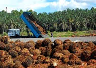
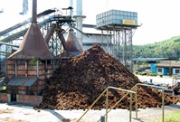
DSC_0238 DSC_0234 What are the pros and cons of oil palm cultivation?

Employment - Our guide told us that 100 people are employed at the oil palm processing factory. What about before and after the oil palm is processed?

Jobs like oil palm harvesting, drivers and refinery jobs are created. When jobs are created, people get money and they are happy.

Forest clearance
Since some companies burn forests instead of clearing them by chopping, this has been blamed for the haze problem in Indonesia.

Like flooding of Batang Ai Lake, biodiversity like animals and plants are lost when forests are cleared.

Good to read

A long newspaper article that generally covers what I wrote above but in more detail
http://www.spp.nus.edu.sg/CAG/Handler.ashx?path=Data/Site/SiteDocuments/Sovacool-Carroll-StTimes.pdf

Learn more about biofuels and how they affect you!
http://www.grist.org/news/maindish/2006/12/04/biofuels/index.html

-------------------------------------------------------------------------------------

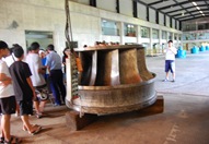
Hydro-electric power
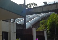
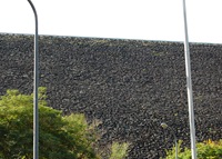
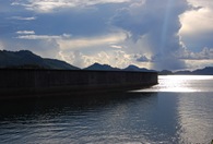
DSC_0312 DSC_0302 Again, pros and cons of HEP (aka positive and negative impacts)
Was it worth it to build the dam?

Social?
Environmental?
Economic?

Who gained and who lost?

We covered these during the night briefing at Hilton Batang Ai. I hope you all didn't just remember the wonderful buffet dinner but remember what we discussed as well.
DSC_0287 DSC_0285

-------------------------------------------------------------------------------------

Ecotourism
DSC_0326 DSC_0390

In your textbook it says ecotourism is tourism to enjoy the environment right?

It's more than that! And many other students who didn't go to Sarawak don't know this secret.

Ecotourism includes

  • Educating the visitors about the place so that they will conserve the environment
  • Benefiting the locals who stay around the area
  • Environmentally friendly

DSC_0382
Let's look at Hilton Batang Ai as a case study
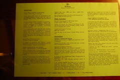
DSC_0437They organise trips (some are free) to share with guests on the history and environmental value of the place. It is hoped that through these activities, visitors will treasure the environment more, both at home and in Sarawak. I took these 2 photos from the room table. They show the activities and try to educate guests on the hotel design.

DSC_0447The boatmen who ferried us across the lake and the staff working from the resort are supposedly villagers staying nearby. Such employment opportunities encourage locals to support the hotel and help conserve the environment for tourism.

Pattaya, a beach resort in Thailand, allowed uncontrolled development of hotels. There was no proper sewage disposal and rubbish and human waste was disposed right into the sea. The sea is now so polluted that it is harmful to swim in it. Hilton Batang Ai, in contrast, has proper sewage treatment and rubbish is transferred to mainland for clearance. It is therefore more environmentally friendly.

Read more about Pattaya Beach here.

Take-away message
There's more to palm oil than the processing. Look at the bigger picture.

HEP brings about positive and negative impacts and affects different groups. It's a difficult choice to make.

Eco-tourism is more than just enjoying a natural place.

Saturday, June 28, 2008

Day 3 Longhouse visit and riverside lunch

DSC_0556 DSC_0626 DSC_0678

First, go think about how different your lives are from the longhouse tribe we visited. Where do they work? How do they live together? What do they eat? How are their living spaces and sanitation like?

Share about how you feel in the comments box below!

----------------------------------------------------------------------------------

Riverside lunch

DSC_0698 DSC_0708

You study about the Geography of food right? It talks about developed countries and less developed countries having difference in food production and consumption. You also study about how technology has affected food production.

Let's talk about consumption here. How do the locals differ from Singaporeans in food consumption?

Where do we get our food from? Where do they get theirs?
How is the food we eat different (both at home and when we're out shopping)?
How about the cooking method?

Good to read
Singapore gets its food from all over the world. We've been particularly hit by the rise in food prices. Try asking your parents how much the price of rice has risen in the past 2 months.

Newspaper report on Singapore food sources

-----------------------------------------------------------------------------------

River features

Do you still remember how the longboat twist-and-turned its way through the river on our way to the longhouse?

The river twist-and-turns (meanders) as a natural process. You should have noticed that at the inner part of the bend, there is always deposition of pebbles. This occurs because water is slower at the inner bend.

Go to this website. In the second photo, you can see that pebbles are deposited at the inner bend because the water does not have enough energy to carry them and has to "drop" them. At the outer bend, water is faster and causes erosion. You can see the exposed tree roots after soil has been eroded.

DSC_0734 DSC_0731

See this animation for explanation on how the above process creates meandering. You'll also see what's an ox-bow lake.

Day 4 Fairy cave and Matang river study

DSC_0792 DSC_0766 DSC_0796
Caves

clip_image002Source: Gillieson (1998) -Caves : Processes, Development, and Management

Here's a cave system. The red part is what we saw in fairy caves. There's actually a whole system above and below the cave we were in (blue).

The top part shows rain and trees right? Rain water, when dissolved with carbon dioxide in the air becomes mild carbonic acidic. The acid from decomposing plants make it even more acidic.

This acidic rainwater seeps through the limestone and dissolves it.

DSC_0184

When this water drips into the cave, some of the dissolved limestone is left behind. Over many thousands of years, the deposited limestone forms a stalactite (c for ceiling). The water that drips to the ground also deposits limestone, forming a stalagmite (g for ground) over time. If these 2 join after many years, it becomes a cave column.

Cave eco-system

P1010500

Caves are sensitive eco-systems because of the lack of light. Species deep inside have adapted to the system. The insects are blind and have no skin pigment. Alot of them also rely on the bat guano (bat shit) to survive.

DSC_0917 DSC_0906 River dischargeDSC_1067

Measuring river discharge is like measuring volume. (length x breadth x height)

But in this case, the height (depth of river) is uneven. That's why we measure the depth at several points and calculate the area.

We recorded the speed of the water flow using ping pong balls. This was to calculate the "length" of water flowing through the river at the point per minute.

Using this "length" and area, the volume discharge per minute is cross section area x speed of river.

An example: If the ping pong ball moves 20 metres in 1 minute, it means the "length" is 20 metres. We multiply this by the cross-sectional area (10m square) and the discharge (volume) is 200m cube per minute.

Never mind the exact steps in measuring discharge. At least you guys saw how it was done. Now... how is discharge applicable in real life?

Discharge increases after rainfall since all the rainwater from the top of the mountain rushes down in streams and joins the river. So when you see that there's rain, keep away from the river!

This is the case in Singapore canals too. The water level at Old Airport Road canal may seem low but can increase suddenly because it just rained at Marine Parade and all the drains are bringing water into the canal and then down into Kallang River. So don't ever play in canals. It may look safe but floods can come anytime!

Take-away message

Caves are amazing natural structures with beautiful formations like stalactites. They support a whole eco-system that has adapted itself to a world without light. All these take millions of years to evolve.

Measuring river discharge is like measuring volume of a cuboid. The exact steps are just for basic information. What you need to know is that discharge can suddenly increase because multiple streams (drains in the case of urban Singapore) contribute rain water to the main river. If this discharge exceeds the capacity of the river, it will flood.

Good to read

Giant Caves of Borneo - Very easy to read book with lots of photos. Tells you more about what's inside caves. Focuses on Sarawak caves.
http://vistaweb.nlb.gov.sg/cgi-bin/cw_cgi?fullRecord+27045+3002+6313596+1+3

The World of Caves - Many photos of how caves are used by humans all over the world.
http://vistaweb.nlb.gov.sg/cgi-bin/cw_cgi?fullRecord+27045+3002+745018+1+9

Friday, June 27, 2008

Day 5 Bako coastal features

DSC_0021 DSC_0029 DSC_0083 DSC_0094

Remember the coastal cliffs and patterns on the sandstone? These are formed by a mixture of physical and chemical weathering.

A quick recap
Physical weathering is breakdown of rocks into smaller pieces by force. Content of the rock remains the same.
Chemical weathering involves breakdown when the content of rock is changed. This is mainly done when acidic rainwater dissolves certain content of the rock.

More about sandstone
Sandstone is a sedimentary rock, meaning it was formed when layers and layers of sand and other particles get cemented together over millions of years. The bonds between these particles are very strong.

However, when some of the particles get dissolved upon reaction with acidic water, holes are formed in the rock and the sand is loosened. That's why when you touched and rubbed the rock surface, you removed alot of sand.

DSC_0103
The dark brown rings and patterns are caused by leeching of iron oxides. Leeching means iron oxides are washed down from the cliff-top soil (and vegetation). When they exit from the rock, these patterns are formed.

Coastal features

DSC_0095

You guys are sitting in a notch. When the water level was higher, the waves "dug" into the rocks, causing erosion. That's why there's a horizontal cut in the rock.

If the waves do enough damage, a sea cave can even be formed!

Headlands and bays

DSC_0612

The bay (beach) usually has cliffs at both sides. That was the case in Bako too.

Headlands_and_Bays
This is how bays and cliffs form. The photo shows a top-view of the coast. The pink areas are the softer materials (sand) while the grey areas are more resistant (sandstone, granite, rocks). With wave erosion, the pink areas (softer) are eroded faster than the grey (harder). Therefore, the grey area sticks out while pink areas form at crescent bay.

Formation of a sea stack

DSC_0798 This was the sea stack we saw on the last day. Watch the video below to understand how it was formed.


Source: http://www.rgs.edu.sg/events/geotrip/stack.html

Here's an animation of how stacks and arches form from a cliff. Basically, the tops of arches collapse to form stacks.

Top-down weathering

DSC_0147The top of the two rocks are still slightly connected to each other. This is in fact a narrow arch. The trees on top of the rock play a part in weathering too. Their roots force their way into the rock joints, breaking the rock into smaller pieces.

If you can recall, this weathering process was also visible at the entrance of fairy cave!

Take-away message
Waves have alot of erosive power and can shape coastal features. Other than the waves attacking the cliff bottom, tree roots exert force from the cliff top and break the rock into smaller pieces.


The videos should also have shown you how features like caves and notches are formed.

Good to read

A guide to Bako National Park - Very good book with many photos. Helps you understand many of the things we saw... solution pans, mangroves.
http://vistaweb.nlb.gov.sg/cgi-bin/cw_cgi?fullRecord+27045+3002+12852567+1+11